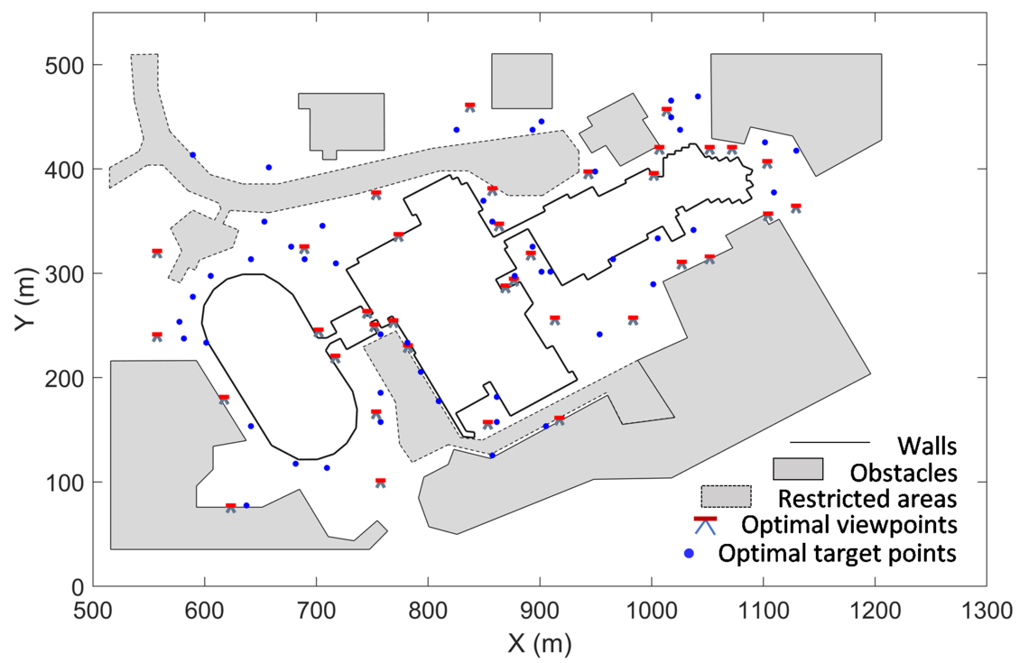
Figure. Optimal scanner and target locations
Aug. 25, 2020

Terrestrial laser scanners (TLSs) can remotely survey object within a few minutes and provide a dense set of 3D measurements, which makes them widely accepted in various fields of application. A single scan is usually insufficient for scanning projects with complex objects and unavoidable occlusions. Also, the scanning quality is influenced by the placement of the scanner. Thus, multiple scans are required to achieve the greatest coverage as well as the satisfactory quality. In addition, targets that perform as common points between multiple scans are necessary in providing a complete object model. Up until now, network establishment for a scanning project is determined empirically according to the operators’ experience and the site conditions. This ad hoc procedure can lead to unnecessary scans in some locations while not satisfying the overall coverage and the reconstruction quality in others. An optimal design system for TLS networks in complex sites was proposed in my PhD research. It provides the design with minimum number of scanner and target locations and satisfactory scanning quality. Figure 1 shows the solution from the proposed system for the scanning of one building complex located on University of Calgary campus.

Figure. Optimal scanner and target locations
Funding source(s): China Scholarship Council
Links to the thesis and publications: